Save The Ribble

A blog dedicated to preserving the beauty and delicate ecosystem of the River Ribble, and opposing any 'vision' to build a barrage on our River and develop on our riverbanks, floodplains and green spaces, causing damage to wildlife and the environment and increasing the risk of flooding to our homes. Save the Ribble Campaign is not responsible for the content of external blogs or websites which link here.

Tuesday, October 23, 2007

Preston Council Leaders Get A Sandbagging In Ribble Flood Furore


Riversway Councillor Jack Davenport made his point about the blindness of the leadership of Preston City Council to issues of flood risk around drainage and flood defences near the Ribble very vividly at the last City Council meeting, he produced two sandbags which he proceeded to place at in front of Council leader Ken Hudson and his ally Danny Gallagher, leader of the Liberal Democrats in Preston.

According to the Lancashire Evening Post Jack Davenport's "attention grabbing stunt" was a protest over the "plans to build homes on flood plains near the River Ribble... sand was spilled all over council papers and prompted a furore in the chamber over how the bags got past Town Hall security"

The protest came a month after the Council flatly refused to debate a motion about the risk of flooding to Preston residents - the council leaders preferring to put the interests of the developers interested in the Riverworks Project ahead of the interests of Preston People.

Council Leader Ken Hudson told this latest Council meeting that:
"The Conservative group is happy to talk to anyone else prepared to look at funding a study for the Riverworks project"

- they are happy to talk to anyone willing to progress the Riverworks barrage but NOT talk to anyone concerned about the environmental impacts or flooding risks!

Bizarrely, Ken Hudson then went on to accuse those councillors concerned about these issues and who DO wish to discuss them of sticking their "heads in the silt of the river... waiting to be drowned" when it is clearly the pro-barrage lobby who are refusing to listen to the evidence and discuss the issues!

Jack Davenport is calling for urgent action in the wake of severe flooding across the country, that shows how vulnerable many areas are to flash flooding, particularly where drainage and flood defences are inadequate. (As they certainly are near Broadgate and Middleforth).

The risk of flooding to residents in these areas would be greatly increased if the council were to build huge new housing estates on the greenbelt and floodplain land that lines the River Ribble, or if they were to build a barrage across the Ribble in order to raise it to permanent high tide level. Preston City Council says they may be 'going back to the drawing board' with some of these plans from Riverworks, due to questions of whether they are acceptable to South Ribble Council. (Though the fact that they are totally unacceptable to ordinary people in both Preston and South Ribble, or to any environmental organisation does not seem to concern our Council Officials)

One Save The Ribble member was so impressed with Jack Davenport's action that he sent him the following email:


Dear Councillor Davenport,

I'm writing to salute your recent protest on behalf of Broadgate residents about the Riverworks plans.

I feel you are doing an excellent job bringing the flood risk posed by the Riverworks Barrage and Housing ideas to public attention, you are doing exactly what a democratic representative of the public should be doing.

You may be criticised for it by a few political hacks, but I definitely think the idea of using sandbags in this way showed imagination, panache and not a little courage, that will be appreciated by ordinary Prestonians.

Thankyou for representing me so well as one of your constituents, and keep up the good work!

Thatcher used to give her ministers a handbagging - Now Jack Davenport gives Preston Council Leaders a sandbagging!


Jack Davenport said to Save The Ribble:

"the issue I was trying to raise was the issue of flooding from drainage. The issue of Riverworks, though related, was not the exact topic of discussion (that is to come), but the general issue however is that the current administration appears blind to the whole thing and won't discuss it. I've heard of putting ones head in the sand, but never putting it in a sandbag!"

Let us know your own response to Councillor Davenport's sandbag protest by replying to this article below!

Labels: , , , , , , , ,

Wednesday, August 29, 2007

Riverworks Bizarre Floating Homes Plan

Preston City Councils latest bizarre idea for our green belt is to build floating homes on the banks of the River Ribble.

The Lancashire Evening Post (LEP ‘Floating Homes’ Planned for City 28/8/07) revealed that a London based company, NGM Sustainable Developments, had met with officers from Preston City Council to discuss the possibility of building floating homes along the banks of the Ribble in Penwortham and Preston.

The homes, which have been pioneered in Holland, apparently remain unaffected by flooding because they can float on top of water and can withstand water level rises of up to four metres.

Councillor Hudson, leader of Preston City Council, welcomed the floating homes as a “very good idea”, while Mike Brogan, the Council’s director for regeneration, admitted that they were looking at technology for new types of housing on water and waterside areas.

Floating homes might indeed be a good idea in Holland where most of the country is below sea level, but why should Preston City Council think we need floating houses in our area? - Particularly as they have previously insisted to local residents (incorrectly) that other key proposal of Riverworks – a barrage on the River – would make flooding less not more likely...?

There are of course thousands of people in Britain who might have been glad to live in floating homes when their towns were inundated with floodwaters earlier in the summer. But let’s not forget that the extensive flooding that has occurred in Yorkshire and other areas this year is known to have been caused by a combination of heavy rainfall and years of building and development on floodplain! – which is of course precisely what Preston City Council’s Riverworks is proposing for the floodplain and green belt areas of Penwortham.

Whilst this perhaps answers the question of why Preston City Council is now suggesting the idea of floating homes as part of their Riverworks initiative to build homes and businesses on our floodplain and green belt – since their very own plans will make flooding even more likely in the area – what about the rest of us? Building on the floodplain – whether the new riverside homes can float or not – STILL INCREASES FLOODRISK FOR THE ALREADY EXISTING HOMES IN LOWER PENWORTHAM AND SOUTH PRESTON!!
If they build on the floodplain, it will no longer be able to work AS floodplain, which is why the Environment Agency are warning against ANY further building on floodplain as this not only puts the new homes at risk of flooding, but increases flooding elsewhere.

The Ribble floodplain operates by soaking up the excess rainfall and releasing it slowly into the River at low tide – as well as coping with the high river waters which heavy rains or high tides bring. If you cover the floodplain with concrete roads, driveways, patios, carparks, and homes (whether floatable or not), the ground is no longer able to act as a sponge, leaving that water as running floodwaters, plus the surface run-off from concrete during heavy rains is much faster and consequently more dangerous.

Local Ribbleside residents have been relieved this summer that our floodplain areas have coped well with the excess rainfall – and a walk on the Penwortham Green Belt will show just how much water this land is still holding even now.


We were of course also extremely fortunate that the flash floods in Broadgate and Penwortham coincided with low tide - flash floods which would themselves have been considerably worse if we did not have our floodplain busily soaking up many thousands of gallons of these rainwaters as they fell.


That the Council wants to factor the floating homes idea into the brief for Riverworks suggests that they may already be concerned about the feasibility of building on our floodplain – particularly after a summer of local and national flooding and clear evidence from the Centre for Ecology and Hydrology that the Ribble is already at increased risk of flooding this Autumn due to more heavy rainfall being expected over the coming weeks.
Of course floating homes might be the solution for those fortunate enough to live in them. But for the rest of us it won’t matter whether the proposed new Riverside homes can float or not – building on the floodplain will increase the risk of flooding to us all.

Floating homes on the Docks is another matter – but along the riverbanks would STILL involve building on the Ribble floodplain. Perhaps Preston City Council, as part of its Riverworks proposals, would like to factor in some ideas and technology that could be used to float all homes in the area in the event of the inevitable floods that will occur if they continue with their dangerous plan of building on our floodplain?

Or perhaps they will finally see sense and spend the many millions this would cost on our woefully inadequate flood defences in Broadgate and on the areas of Preston that really could do with some hard cash input - and leave the floodplain undeveloped so it can get on with what it does best: helping to protect our communities from flooding?

Read more about the new Increased Floodrisk Alert for the Ribble;

and Why our Flood Defences need urgent repairs NOW;

and Why a Ribble Barrage & Floodplain Developments will be Disastrous for our Environment.

Contact us at savetheribble@tiscali.co.uk

Labels: , , , ,

Saturday, August 25, 2007

Ribble Increased Floodrisk Alert for Autumn and Winter

The River Ribble is at "an increased risk of flooding" over the next six months, through Autumn and into Winter.

This increased floodrisk is due to the high levels of rainfall we are experiencing this year, which has had the effect of saturating the Ribble's floodplains pretty much to capacity with no prospect of drying out before the wet Autumn that forecasters are predicting begins.

The extraordinarily high levels of rain that have already fallen this Summer are 200% above the average from May to July, making the ground saturated throughout the Ribble corridor, particularly on the low-lying floodplains.

These figures have been released by the Centre for Ecology and Hydrology, whose statistics also show that:

'the speed of the River Ribble is 465% faster than average and that the water saturated in the soil is at an exceptionally high level.' according to This Is Lancashire.

Ribbleside residents are eternally grateful for our floodplain areas which have protected our communities from the serious floods which have affected so many areas so far this year, and for our free-flowing River which drains all that rainwater away (the Ribble being at low tide during local episodes of flash-floods in Preston and Penwortham meant the floodwaters were drained quickly), but it seems that the threat is not over. The already saturated ground will not be able to hold much more of the predicted high levels of rainfall expected over the Autumn and Winter months, which means that the Ribble will be at "an increased risk of flooding" during the coming months as the floodplains will struggle to cope.


Flash floods earlier this summer in Middleforth, Penwortham and Broadgate, Preston.

As Save The Ribble have pointed out, the Flood Defences in the Broadgate area are in a woeful state of repair and we need Preston City Council to spend money on repairing our essential flood defences NOT on funding feasability studies for barrages and floodplain building developments which will ruin our environment and actually INCREASE OUR RISK OF FLOODING.


Broadgate during high rainfall and a speeding Ribble surging past those fragile post-and-panel defences.


According to This Is Lancashire, 'The Environment Agency has already given "an enhanced flood risk" warning to all of England and Wales, and with forecasters predicting a wet autumn the Ribble looks set to have another record breaking season, which can only be bad news for residents on the Ribble floodplains.'

The Centre for Ecology and Hydrology summarise their findings:
'The Monthly Hydrological Summary for the UK, published today [15th August 2007], includes an analysis of the unprecedented summer flooding. The wettest May-July period for England & Wales in a record from 1767 resulted in near-saturated soil conditions and river flows more typical of a notably wet winter, with extensive floodplain inundations in both June and July. In the July Hydrological Summary, scientists at the Centre for Ecology & Hydrology and the British Geological Survey provide a detailed appraisal of a summer flood episode that has no close modern parallel.'

This Is Lancashire report that the the Centre for Ecology and Hydrology statistics show 'the speed of the River Ribble is 465% faster than average and that the water saturated in the soil is at an exceptionally high level.'

Spokesman for the CEH Barnaby Smith told This Is Lancashire that "The soils are extremely wet in comparison with previous summer months and with more rain predicted it is unlikely soils will dry out. We are going to get more floods. The River Ribble will be vulnerable to winter floods over the next six months."'


Ian Rowland, Flood Risk Manager for the Environment Agency told This Is Lancashire that "We are dealing with a force of nature here and you can never say never to a flood occurring. We can only manage the risks.

"However we do monitor flood levels throughout the year and try to attain the strongest possible idea of whether a river will flood.

"In the event of a flood we ensure the river is put on high alert and flood warnings are sent out to the local media."

'It will depend on weather patterns throughout the winter months if the Ribble breeches its banks however some of the causes of flooding are already in place along much of the Ribble.

The Environment Agency encourages those who believe they are at a serious risk flooding of flooding to call the Floodline on 0845988188 or visit www.environment-agency.gov.uk, and sign up for direct flood warnings.' (This Is Lancashire)


For more on issues of flooding and the Ribble see:
the Dangers of Riverworks;
Why A Barrage Will Increase Ribble Floodrisk;
Why building on the Penwortham Green Belt will increase floodrisk;
and why the Environment Agency are opposed to further developments on floodplain.

You can read the This Is Lancashire story here.

You can contact us at savetheribble@tiscali.co.uk

Labels: , , , , ,

Thursday, July 26, 2007

Invest In Flood Defences Not A Barrage!

Jack Davenport, Preston City Councillor for Riversway ward, called in a letter in the Lancashire Evening Post today for money that the Council and Vision Board are planning to waste on feasibility studies into the unwanted Ribble Barrage, to be used instead on investigating the improvement of Preston's flood defences.

His call is underlined by disastrous flooding in Hull, Doncaster, Tewkesbury, Gloucester and many other parts of the UK.

Even a cursory visual inspection of the 'panel and post' flood defences along Broadgate shows that they are old and showing worrying signs of deterioration.


This is just one of a number of pillars with large vertical cracks.

Here are a few more:


It seems likely that in winter when water turns into ice inside these cracks, it will cause them to worsen.


This is where a small vertical crack meets a horizontal crack in one of the panels, that extends for several feet.


Tree roots are also making their way beneath the flood barrier and breaking the pavement on the other side.


The faces of some of the panels are worn, showing rusty steel underneath.


Despite recent flash flooding, the council has done nothing to clear blocked drainage in the area.

The flood defences protect a large amount of local housing.

We at Save The Ribble are not experts on Flood Defences, but we share residents' concerns about these cracks, and about the post and panel flood defences that should now be upgraded given the clear threat of flooding when the river is in spate, a risk that any kind of obstruction in the river, like a barrage, can only exacerbate.

Labels: , , ,

Tuesday, June 26, 2007

Widespread Flooding Highlights Barrage Dangers

Yesterday was a day of widespread flooding across the UK, which luckily we in Lancashire escaped.

The worst of the flooding was in the North East, Yorkshire and Lincolnshire, particularly the River Don near Sheffield, and currently people living near the Ulley reservoir dam are being evacuated as it is showing signs of cracking.

Save The Ribble has been trying to explain to our council officials and developers that torrential rains like this are likely to become much more common as global warming takes effect.

A river barrage that permanently raises our river to high tide, coupled with 4000 new homes in the Ribble flood plain would raise the water table beneath our homes, and exacerbate the risk of flash flooding as land that could previously soak up excess water is covered with concrete and tarmac. A barrage would prove to be an obstacle to the Ribble when it is in spate.


Preston and Penwortham recently had their own flash floods,
which luckily for us, occurred when the Ribble tide was out. Had a barrage been present, holding the river at high tide and preventing the free outflow of these waters, the consequences for local residents could have been far worse.

Labels: , ,

Monday, June 11, 2007

Were We Glad the Ribble Was at Low Tide?

Yes.

Were we glad that the Ribble doesn't have a barrage, keeping the riverwater at a permanent high level so that the tide never goes out?

You bet.

Today's torrential downpour caused chaos and several flooded streets in Penwortham and Broadgate...


Some houses suffered flooding...


...and Middleforth really lived up to its name.

Leyland Road was one of the worst affected, several shops suffered flooding...


...and the wash caused by the traffic didn't help matters...


...although it also brought a great deal of laughter and enjoyment!


To our relief, the flash flood coincided with low water levels on the Ribble...


... so the drains quickly took the flood waters into the Ribble to safely drain away...


...the force of the waters gushing through the large number of drains into the Ribble was a loud and impressive sight...


...but they did the job quickly and efficiently so that less than one hour later...


...it was as though it had never happened...

... although those houses and shops which did experience flooding inside the buildings will still have work to do drying out.

As the tide was out - and the water level NOT artificially raised by a Barrage - the flash floods drained away quickly, so not too many buildings were breached. If the river water had been at a higher level, the flooding would have been much more severe as the drains would not have been able to let the water out.

Many local residents were particularly relieved the flood subsided so quickly as the flood was inches from a great many more front doors...


According to the LEP, one family had to climb down the riverbank to prise open their local storm drain as it was jammed shut - what would happen if all those drains are closed under permanently high water levels on a barraged Ribble just does not bear thinking about...

What a difference in weather from just a couple of days ago when local residents were Spring Cleaning the Riverbank in glorious sunshine rather than wading through our flooded streets! It seems that Summer or Winter, high rainfall can cause flooding anytime, so we are glad our river is free and open to drain over 75 linear miles of the North West, and who knows how many square miles of Lancashire in total, from North to South, East to West, drains into the Ribble...

Long Live the Ribble Wild!

You can contact us at savetheribble@tiscali.co.uk

Labels: , , , ,

Thursday, March 08, 2007

Flood Defence Lies Nailed

Advocates of the Riverworks Ribble Barrage idea have been busy making the false claim that somehow a barrage designed to raise the river level can also protect us against floods. This idea has even been slipped into the Local Development Framework documents, when all the evidence shows the opposite.

Readers of tonight's Lancashire Evening Post will have seen Mike Winrow of Longton's letter where he exposes the flood defence myth - he points out that the proposed barrage would be totally useless against flooding when the river is in spate:

"What if there were a Carlisle-style flood... would the sluices be closed when the tide came in?.. No, they'd be wide open, no matter how high the tide, and then it would be in the lap of the gods whether flooding occurred. It only makes sense to close the sluices when there is more water coming upriver than going down, but this will only occur when there's relatively small amounts of water in the river, and no flood risk, no matter how high the tide"

Click on the picture to read the letter in full

Mike Winrow's arguments echo those in the River Ribble Weir Appraisal, written in 1986 by expert consultants Halcrow who were commissioned by the council the last time they wanted to barrage our river. Their in-depth study points out that barrages and weirs in the river INCREASE the risk of flooding when the river is in spate, and gives a long list of reasons why barraging the Ribble to turn it over to 'leisure use' would be totally impractical and raise the flood risk to local people.

There are two possibilities. The people who are making claims that the barrage will defend us from flooding have read the Halcrow River Ribble Weir Appraisal, in which case they are knowingly telling lies when they claim that the barrage would be a flood defence, or else they have not read this key document, in which case they are proving themselves to be unprofessional and lacking the competence to plan the future of our city.

Meanwhile, another blogger, Ken who writes South Ribble Tales has hit out at the Riverworks scheme, and the arguments of property developer Tarquin Scott, here is what Ken wrote so eloquently on his excellent local blog:

Now then , the Ribble Barrier will bring wonderful benefits to South Ribble and Preston will it? A power station, waterbuses, a new road, and 4000 houses, cor blimey!
Some folk just do not get it or at least only see the £ signs. All those proposed benefits seem like a disaster for the enviroment around the river and beyond.
Why would building a new road link down a quiet counrty lane across farmland be a benefit? How are building 4000 homes within walking and cyling distance of Preston going to make people walk and cycle? There are already 1000's of homes within that distance and I do not notice the roads bursting with bikes and the footpaths overflowing with pedestrians. Lets get that plan going first so proving it could work that way.
The best one though is the waterbus. How big is this going to be, how many do they plan to use, how fast will they travel? Do the planners seriously think commuters would use them? Forgive me but the last time I looked the river does not pass any major factories or schools or anything else that people would commute too. Presumabley they would also employ an icebreaker for winter as a slow flowing waterway would regularly freeze over. Why are tourists are going to be attracted to this? There is nothing in our parks that make them that attractive to a visitor. Beautiful as our parks are they are not a tourist attraction. They would need facilities, a cafe, toilets, bike hire, shops, carparking etc etc as well as the infrestructure associated with the buses themselves. In any case any tourists would increase traffic along with the other 4000 homes rapidly filling the new roads.

The Ribble is a fast flowing river with a burden of mud and silt. If a barrage is built this will be dropped in the Preston area, in turn this will lead to erosion elsewhere. I am not an expert but if more silt is laid down upstream surely this must lead to increases flooding risks so more protection would be needed for any buildings on the natural floodplain.
There is an abundance of wildlife that will have its environment changed forever.
I have seen as many as 30 herons fishing in the rising and ebbing tide on the silt at the bullnose. That would be lost forever. (just one small example of the impact)
The peace and tranquility of a large area west of the docks would be destroyed with roads and industrial development.
Remember the Ribble Bore, what an impressive sight that is. What would happen to this?
Look at the amount of flotsam and jetsam (rubbish) on the banks. What will happen to this if there is no tide? Maybe it will eventually collect at the new power station and jam it up.

Yes, I say develop the river, encourage people to use the open spaces and natural environment provided by our river, there is much potential there. But no, a barrage is not a development for me.
It looks like another docklands type plan. Good on paper in money terms, but in reality a big disappointment to the people who saw the potential lost to car dealerships, stores and distinctly smelly water.

Labels: , , ,

Sunday, February 11, 2007

Protecting Ribble Communities from Flooding: Why a Barrage Won't Work

The River Ribble and its Estuary, and our Green Belt/floodplain areas are locally, nationally, and internationally important to wildlife, as well as important to local communities.

This is why the Ribble is protected by UK, EU, and International law, why the Green Belt has been protected from development for decades, and why the Environment Agency recommend that no building development should be allowed on the floodplain, or other areas at Significant Risk of flooding.


Local residents are concerned about the potentially devastating effects that certain elements of the Riverworks proposals would have on the environment (particularly a Ribble Barrage or weir, and building developments on the Ribble's Green Belt which is also its floodplain), both in terms of wildlife and the ecosystem, and in terms of potentially increasing flood risk to our communities.

In response to our concerns, has there been an assurance that no such scheme will be pursued? No: there appears instead to have been an implicit shift in the suggested reason for a Ribble barrage into a perceived necessity to defend Preston from the sea... are they trying to scare us into having it?

Yet, it seems that local residents' understanding of the Ribble's intertidal ecosystem is the correct one, as two professional documents show:

The Ribble Shoreline Management Plan

and the

"River Ribble Weir Appraisal"


1. The Ribble Shoreline Management Plan:


Climate Change is a long term threat to a number of aspects of our environment, but one which causes much concern for North West communities who live close to the sea and rivers is the predicted rise in sea levels coupled with a predicted rise in rainfall. This could be a direct threat to our communities, and to the rare Wetland habitats which border these areas.

Ribble Saltmarsh - more rare than rainforest, and a UK Priority Action Plan Habitat.

This is why the Ribble Shoreline Management Plan (SMP), which extends from the furthest points where the Estuary meets to sea upriver as far as Old Penwortham Bridge, assesses the risk of flooding to all our communities along the Ribble Estuary on an on-going and very detailed basis, at the same time as examining the on-going risks of climate change to the Ribble Estuary's Internationally important Wetland ecosystem.

- The Ribble SMP has identified no need whatsoever for a tidal barrage to protect any of the Ribble communities from flooding.

- In fact, the Ribble SMP has identified the active continuation of the creation of further wetland habitat (saltmarsh and mudflat provision) as the most sustainable and effective means of ensuring flood protection for all of our communities, as well as ensuring the ongoing provision of this vital ecosystem for the sake of the environment, therefore actively protecting both human and wildlife habitats from sea level rises and storm surges.

- This is also in line with both Environment Agency and Defra policy regarding flood defences and environmental protection on all levels (wildlife and human) in the long term.


The SMP advocates the provision of more wetland habitats of saltmarsh and mudflats, plus the maintenance and strengthening where necessary over the coming decades of the existing artificial flood defence banks which already exist in several areas, as all that is necessary to continue to defend our communities from the sea. The next phase of this is already taking place as work begins in the coming weeks at Hesketh Out Marsh.

It is also the case that the Ribble SMP identifies the communities at greatest risk from sea-level rises along the Ribble to be NOT Preston, or Penwortham, but particularly low-lying communities like Southport and Crossens, and Formby Point is now experiencing erosion.

It is also conceivable that these low-lying communities could potentially be put at greater risk of flooding from the sea by a barrage at the Preston end of the Estuary as the tidal flow would no longer be able to progress naturally to its full 11 miles inland, therefore could cause the incoming tides to "bounce-back" off the barrage and onto other areas of the Estuary shoreline.

Yet a Ribble Barrage could still place Preston and Penwortham, and other communites upriver of a barrage (including Walton le Dale, Ribchester, and even beyond) at greater risk of flooding too - from the River Ribble itself.

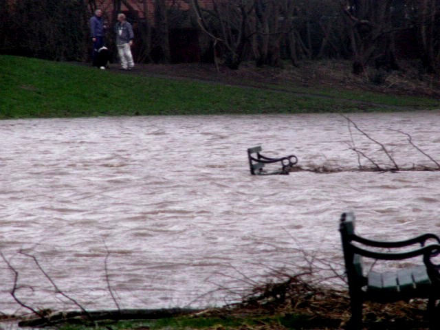
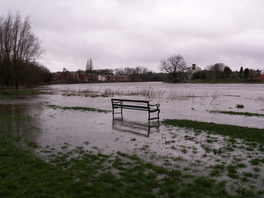
Submerged bench in Middleforth, Penwortham, looking towards Broadgate, Preston, January 07.

All of these communities lie on the Ribble's floodplain, not the sea's, therefore a Barrage on the Ribble would not protect us from the sea, but could put us at increased floodrisk during periods of rainfall when the Ribble effectively becomes the rainwater drain from West Yorkshire through Lancashire to the Ribble's Estuary - a run of over 70 miles.

It is common-sense to anyone who understands how the Ribble operates - or has merely seen the Ribble in spate - that this would be a potential risk, as artificially-high water levels, coupled with the silts building up behind a barrage and thus further reducing capacity, do not leave much room for high rainfall spate waters to be carried safely without flooding.
Permanently high water levels created by a barrage could also raise the water table underneath our homes and cause numerous land-drainage problems - risks which would be compounded by the loss of local floodplain areas to massive housing developments and business parks.

These very risks have also been highlighted by a professional consultancy who were commissioned by Preston Borough Council and South Ribble Borough Council c.1986 to assess the feasability of a weir on the River Ribble.


2. "River Ribble Weir Appraisal"


This report was undertaken for the councils by Halcrow & Partners in 1986, at the time of the previous docks redevelopment and also the time of one of the many previous ideas to build a weir or barrage on the Ribble.

Whilst this Appraisal does not adequately assess the potential environmental impacts, and clearly does not appreciate either the environmental significance or the real beauty of what it refers to as 'the unsightly river bed and banks', it does raise some very pertinent issues, many of which echo our own concerns.

It also makes it clear that the Ribble would need a MINIMUM of 2 weir structures to potentially enable its recreational use by boats, and the optimum number would be 4, and the report also emphasises that even this number of “weirs” would only allow SOME areas to be navigable.

Here are some of the pertinent points the Ribble Weir Appraisal makes:

1. Upstream of Old Penwortham Bridge, 'flooding is more linked to the flow of the river itself' than to tidal surges, and as such, any weirs would need to be "gated" 'so that the retained water level can be lowered in advance of heavy river flows' to prevent flooding;

2. 'The higher the retained water level in the river the more likely the need to provide sub-surface drainage and possibly pumped drainage' - both of which are proving necessary and very costly in Cardiff and York;

3. 'high river levels can already suppress free drainage to cause difficulties ... Therefore the raising of water levels by a weir over low tide water levels is of major concern';

4. 'The concentration of dissolved oxygen in the river upstream of a weir can fall with the consequence that fish life cannot be supported' - the report does not discuss the equal risk low oxygen poses in causing blue-green algae;

5. 'The effect of a weir near the entrance to the former dock basin on the behaviour of the river channel downstream is a matter of serious concern' in respect of siltation. The issues of changes to siltation, and the integrity of the artificially-cut river channel and siltation changes, both potentially leading to flood risk, are also highlighted in the assessment of flood risk to Ribble communities in the Shoreline Management Plan;

6. The lowest weir (near the entrance to the dock) ‘would result in a reduction in tidal cubature (the total volume of water moving first upstream then downstream during one tidal cycle)' as the river would already be held at higher levels, but the Report does NOT discuss the issue of how the weir-induced prevention of tidal flow may impact on communities downstream of the structure...

The report does make suppositions that this prevention of the tide could reduce siltation upstream, but this is inaccurate as it presumes all silts come upriver on the tide, whereas a large amount of silt actually flows downriver.
Estuary ecologists such as Dr. Alan Bedford at Edge Hill University, and Graham Clarkson of the RSPB can confirm this - as can any visit to the river during rainfall periods as the river is distinctly brown!

7. The report points out that only by retaining water at the highest tide levels could the perceived "aesthetic quality" of the river be achieved (ie to cover the mudflats and debris), and emphasises that 'to realise the recreational potential of the river a higher water retention level is required' at the same time as emphasising that the highest water levels also mean the greatest floodrisk (see points 1, 2 & 3 above).

8. Despite more than two weirs (probably 4 altogether) being necessary to allow the stretch from the Bullnose to the Tickled Trout to be POTENTIALLY navigable due to the fall in the river bed, even with two or four weirs access to all areas between these points will either 'only be possible at very high water' or even 'likely to be impossible' as some sections of the river would still 'remain relatively shallow'.

9. The report emphasises that any potential recreational use (ie boating) on the river that a weir could bring does, then, have the significant 'drawback... that a high river flow may bring about flooding at times of adverse weather conditions' therefore "gating" the weirs is essential, yet the proposed water sports facility could still effectively be rendered useless for large periods of time as the gates will have to be left open to prevent flooding to local communities. The Appraisal suggests that:
- 'one possible solution... would be to make the retention levels seasonal' (ie only allow the weirs to be closed to retain higher water levels in the summer months) but 'even if a seasonal approach is adopted, there will still be occasions in the summer months when there is a risk of flooding'
- plus the visual impact of the exposed weirs when open would not be very pleasant, particularly as debris would accumulate there...

So the necessity of leaving the gates open for what could well be half the year would ensure that the proposed water sports facility would be pretty useless, causing disasterous consequences to the Ribble's delicate ecosystem for nothing...

10. The Report also notes that 'further research is required on the extent of downstream siltation and upstream drainage problems that may arise through the construction of a "weir" ' as the adverse impacts of these would need to be seriously examined.

Of course, 20 years later, we would also take the environmental impact on the wildlife much more seriously, and the effects of changes in siltation and water flows, hydrology and predicted weather/climate patterns, on both sides of any such structure as an essential consideration, and as such, would throw out this absurd scheme immediately!

That the Ribble Shoreline Management Plan shows NO NEED FOR A BARRAGE OR WEIR TO PROTECT RIBBLE COMMUNITIES FROM FLOODING says enough - even without the damning professional evidence from a report commissioned 20 years ago!

The Ribble SMP, plus the Ribble Catchment Integrated Management Plan and the Ribble Pilot Waterframework Directive form our collective blue-prints for protecting our precious water resource, our environment, and preventing flooding to all of our communities in the medium to long term. The SMP alone is looking at the next 50 to 100 years as its predictive and planning framework, and this Plan now extends beyond its present scope at the Douglas or Asland as far upriver as Old Penwortham Bridge.

It seems common-sense to presume that all the potential flooding and drainage problems highlighted in Halcrow's "Ribble Weir Appraisal" would be exacerbated by rising sea levels, higher rainfall (also predicted for the North West from climate change), and by building on what remains of the river's floodplain thereby further reducing capacity to cope.

It is clear from professional sources that the Riverworks barrage or weir, the floodplain/green belt development ("Central Park" housing and business development on the South Ribble bank and the Riverside East development on the Preston bank), could cause irreversible damage to the environment at the same time as increasing the flood risk to our communities.

The proposals to concrete large sections of the riverbank through to Brockholes would also have a significant effect on the Ribble's flow, speeding up its progress downstream which could also have an impact on the safety of spate waters - and also directly contravenes both the current Biodiversity Action Plan Habitat work and the Ribble Catchment Integrated Management Plan work to protect and enhance the Ribble's precious banks for Otters and Water Voles, and plant and fish/invertebrate/shellfish species...


The Obvious Conclusion?

The "Ribble Barrage Weir Appraisal" and the Ribble shoreline Management Plan shows that those who oppose the Ribble barrage have a cast iron case that no intelligent person can deny. Both documents clearly show why the barrage won't work - and it seems very amateurish of the council that they do not seem to be aware of these consequences.

It’s time that Preston City Council and the unelected Vision Board STOP WASTING TIME AND COUNCIL TAX PAYERS' MONEY PURSUING WHAT IS CLEARLY AN IRRESPONSIBLE AND UNNECCESARY SCHEME AND ABANDON THE PROPOSED RIBBLE BARRAGE AND FLOODPLAIN BUILDING DEVELOPMENTS NOW!

As a final point, it's very interesting to discover that local opposition to weirs and barrages on the Ribble has a very long and honourable tradition - dating back to at least 1562 when local fishermen objected to a weir at Brockholes which had been constructed to prevent fish migrating upriver to their spawning grounds to make them easier to catch...

and in 1805 a courtcase to remove another such weir from the same spot was concluded with these words:

'The right set up by the defendent to have a stone weir is plainly founded upon encroachment. The erection of weirs across rivers was reprobated in the earliest periods of our law. They were considered as public nuisances. The words of Magna Carta are that "all weirs from henceforth shall be utterly pulled down... throughout all England"... and this was followed up by subsequent Acts, treating them as public nuisances, forbidding the erection of new ones...'

("The Ribble Salmon Fisheries" by A. T. R. Houghton p42; & 49)

One wonders whether this law against weirs across rivers in England has ever been repealed...?

You can contact us at savetheribble@tiscali.co.uk

Labels: , , , ,

Thursday, January 18, 2007

The River Wild

The River Ribble is not a pretty chocolate-box river - she is beautiful, wild and free, her moods changing from calm to stormy in hours...


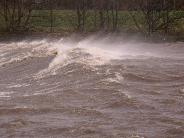
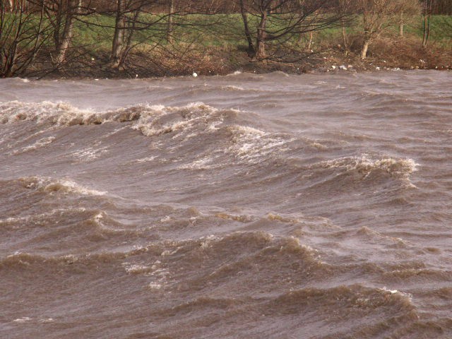
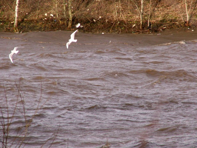
This isn't the sea on a stormy Winter's day, it's the River Ribble, in spate and flowing between Preston and Penwortham to the sea...

These pictures were taken today, 18th January 07, from high tide until 2 hours later...


...walking downriver from Priory Park in Penwortham - where huge waves were whipped into spray by the high winds...


... and it was difficult to believe that the tide had been going OUT for over an hour at this point...


... walking back upriver over an hour later, by Liverpool Road Bridge the surface was more calm but flowing down towards the sea at high speed, drowning the riverside footpath here near the allotments...


... and Broadgate sails by as the Ribble speeds on her way to the sea...


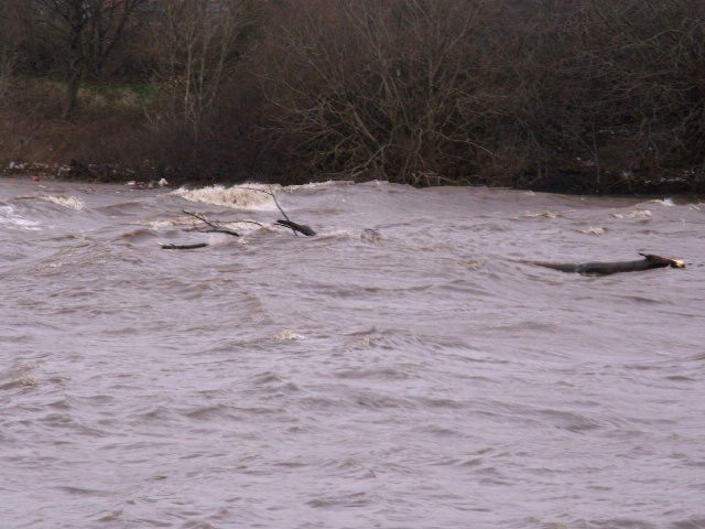
...and trees are carried down towards the sea on the Ribble's spate waters at high speed...


... and Leyland Rd is very close indeed, here near the Bridge Inn...


... the Riverside footpath on the Penwortham side has disappeared altogether under the flood waters...


- careful with that poop scoop -


...the bench usually overlooks the Ribble here, set back from the river's edge by several metres, but today it is swamped by the spate waters, despite high tide being 2 hours earlier...


... to compare with low tide and little rain a couple of weeks earlier, these joggers are passing the same benches...


- the high rainfall and high river level means the water table rises -


- including on Margaret Rd, but luckily the spate waters will drain down to the sea in a matter of hours, allowing the water table to subside too...


... the drains backing up and spraying water out are an impressive sight (but only if not in your kitchen or back garden!)...


Long Live the Ribble Wild!

savetheribble@tiscali.co.uk

Labels: , , , ,

Saturday, April 08, 2006

Ribble in flood in Penwortham


Here's a picture taken on March 28th 2006 of the Ribble in Penwortham, breaking its banks after heavy rain. If a barrage is built, the River level will be permanently higher instead of its current tidal changes, the silts will progressively reduce the volume of the River bed thus reducing the capacity of the River and it's ability to deal with rainfall run-off. Rainfall run-off will also increase if they build the thousands of new houses on this floodplain, and a permanently high river level will cause groundwater to rise beneath both new and existing homes.

Labels: , ,

"The care of rivers is not a question of rivers, but of the human heart" Tanako Shozo Save The Ribble Logo